
Gratis-Karten: Booklet-Charts der NOAA
Gratis-Karten: US Virgin Islands und Puerto Rico
Testweise hat die National Oceanic and Atmospheric Administration (NOAA) Seekarten als PDF-Downloads ins Internet gestellt. Die nautischen Karten sind im Maßstab etwas kleiner gehalten. Jedoch erlaubt eine angepasste Skala auf den Seiten das korrekte Abgreifen der Distanzen.
Hier geht's zum Download.
Folgende Seegebiete sind erhältlich:
NOAA Booklet Charts Puerto Rico UVI
Atlantic Coast
(including Puerto Rico and the Virgin Islands)
NUMBER
SCALE
TITLE
Home
BookletChart Home Page
Catalog
N/A
Atlantic Coast Catalog
11009
1,200,000
Cape Hatteras to Straits of Florida
11013
1,200,000
Straits of Florida and Approaches
11432
50,000
Everglades National Park Shark River to Lostmans River
11433
50,000
Everglades National Park Whitewater Bay
11434
180,000
Florida Keys Sombrero Key to Dry Tortugas
11438
30,000
Dry Tortugas;Tortugas Harbor
11439
80,000
Sand Key to Rebecca Shoal
11441
30,000
Key West Harbor and Approaches
11442
80,000
Florida Keys Sombrero Key to Sand Key
11445
40,000
Intracoastal Waterway Bahia Honda Key to Sugarloaf Key
11446
40,000
Intracoastal Waterway Sugarloaf Key To Key West
11447
10,000
Key West Harbor
11448
40,000
Intracoastal Waterway Big Spanish Channel to Johnston Key
11449
40,000
Intracoastal Waterway Matecumbe to Grassy Key
11450
180,000
Fowey Rocks to American Shoal
11451
80,000
(Not Available) FOLIO SMALL-CRAFT CHART Miami to Marathon and Florida Bay
11452
80,000
Intracoastal Waterway Alligator Reef to Sombrero Key
11453
40,000
Florida Keys Grassy Key to Bahia Honda Key
11460
466,940
Cape Canaveral to Key West
11462
80,000
Fowey Rocks to Alligator Reef
11463
40,000
Intracoastal Waterway Sands Key to Blackwater Sound
11464
40,000
Intracoastal Waterway Blackwater Sound To Matecumbe
11465
40,000
Intracoastal Waterway Miami to Elliot Key
11466
80,000
Jupiter Inlet to Fowey Rocks;Lake Worth Inlet
11467
40,000
Intracoastal Waterway West Palm Beach to Miami
11468
10,000
Miami Harbor
11469
100,000
Straits of Florida Fowey Rocks, Hillsboro Inlet to Bimini Islands, Bahamas
11470
10,000
Fort Lauderdale Port Everglades
11472
40,000
Intracoastal Waterway Palm Shores to West Palm Beach;Loxahatchee River
11474
80,000
Bethel Shoal to Jupiter Inlet
11475
10,000
Fort Pierce Harbor
11476
80,000
Cape Canaveral to Bethel Shoal
11478
40,000
Port Canaveral;Canaveral Barge Canal Extension
11480
449,659
Charleston Light to Cape Canaveral
11481
25,000
Approaches to Port Canaveral
11484
80,000
Ponce de Leon Inlet to Cape Canaveral
11485
40,000
Intracoastal Waterway Tolmato River to Palm Shores
11486
80,000
St. Augustine Light to Ponce de Leon Inlet
11487
40,000
St. Johns River Racy Point to Crescent Lake
11488
80,000
Amelia Island to St. Augustine
11489
40,000
Intracoastal Waterway St. Simons Sound to Tolmato River
11490
40,000
Approaches to St. Johns River;St. Johns River Entrance
11491
20,000
St. Johns River-Atlantic Ocean to Jacksonville
11492
40,000
St. John's River Jacksonville to Racy Point
11495
40,000
St. Johns River Dunns Creek to Lake Dexter
11498
40,000
St. Johns River Lake Dexter to Lake Harney
11502
80,000
Doboy Sound to Fernadina
11503
25,000
St. Marys Entrance Cumberland Sound and Kings Bay
11504
40,000
St. Andrew Sound and Satilla River
11505
40,000
Savannah River Approach
11506
40,000
St. Simons Sound, Brunswick Harbor and Turtle River
11507
40,000
Intracoastal Waterway Beafort River to St. Simons Sound
11508
40,000
Altamaha Sound
11509
80,000
Tybee Island to Doboy Sound
11510
40,000
Sapelo and Doboy Sounds
11511
40,000
Ossabaw and St. Catherines Sounds
11512
40,000
Savannah River and Wassaw Sound
11513
80,000
St. Helena Sound to Savannah River
11514
20,000
Savannah River Savannah to Brier Creek
11515
20,000
Savannah River Brier Creek to Augusta
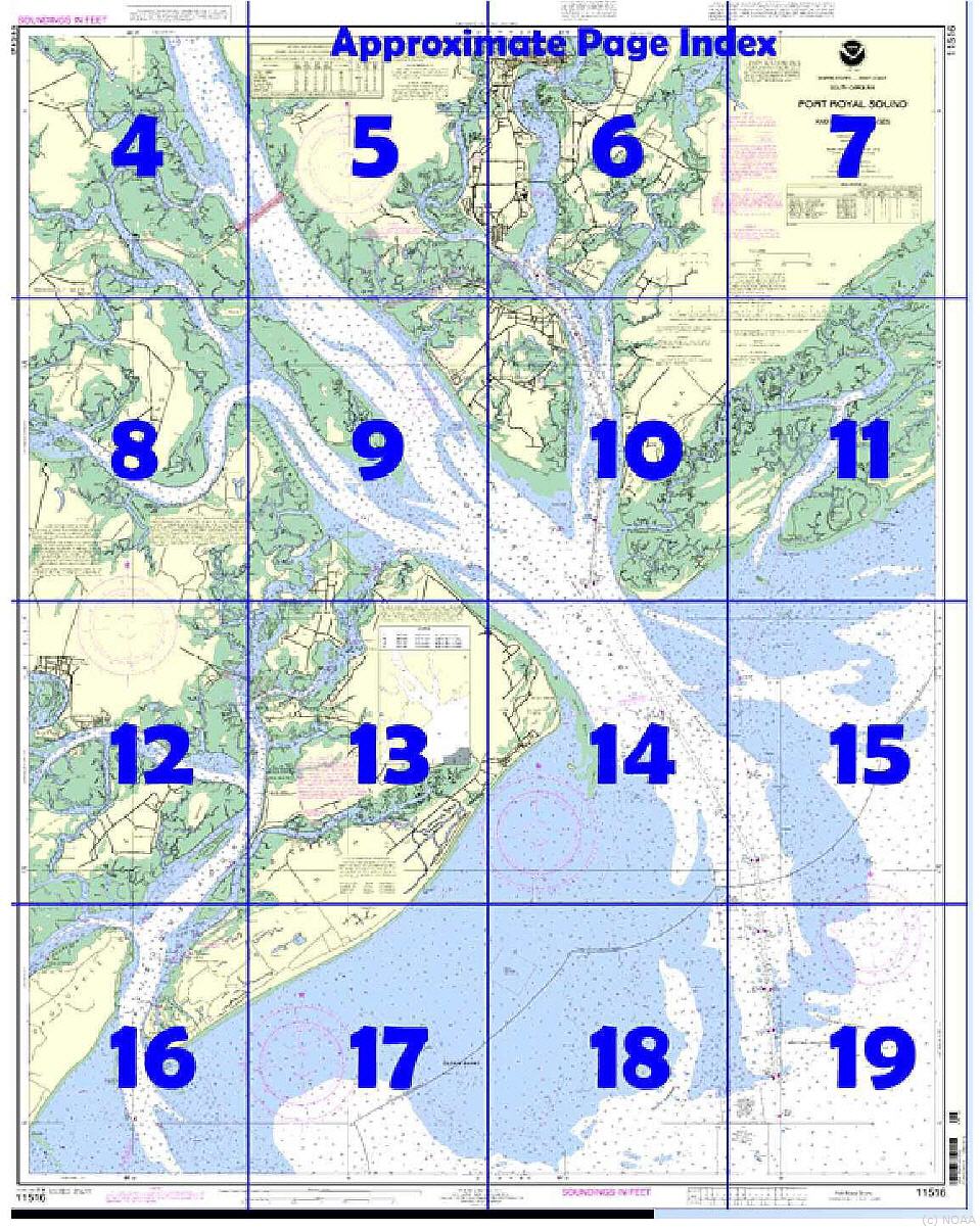
11516
40,000
Port Royal Sound and Inland Passages
11517
40,000
St. Helena Sound
11518
40,000
Intracoastal Waterway Casino Creek to Beafort River
11519
40,000
Parts of Coosaw and Broad Rivers
11520
432,720
Cape Hatteras to Charleston
11521
80,000
Charleston Habor and Approaches
11522
40,000
Stono and North Eclisto Rivers
11523
20,000
Charleston Harbor Entrance
11524
20,000
Charleston Harbor
11526
20,000
Wando River Upper Part
11527
20,000
Cooper River Above Goose Creek
11531
80,000
Winyah Bay to Bulls Bay
11532
40,000
Winyah Bay
11534
40,000
Intracoastal Waterway Myrtle Grove Sound and Cape Fear River to Casino Creek
11535
80,000
Little River lnlet to Winyah Bay Entrance
11536
80,000
Approaches to Cape Fear River
11537
40,000
Cape Fear River Cape Fear to Wilmington
11539
80,000
New River Inlet to Cape Fear
11541
40,000
Intracoastal Waterway Neuse River to Myrtle Grove Sound
11542
40,000
New River;Jacksonville
11543
80,000
Cape Lookout to New River
11544
80,000
Portsmouth Island to Beaufort, Including Cape Lookout Shoals
11545
40,000
Beaufort Inlet and Part of Core Sound;Lookout Bight
11547
15,000
Morehead City Harbor
11548
80,000
Pamlico Sound Western Part
11550
40,000
Ocracoke lnlet and Part of Core Sound
11552
40,000
Neuse River and Upper Part of Bay River
11553
80,000
Intracoastal Waterway Albermarle Sound to Neuse River;Alligator River;Second Creek
11554
40,000
Pamlico River
11555
80,000
Cape Hatteras-Wimble Shoals to Ocracoke Inlet
12200
419,706
Cape May to Cape Hatteras
12204
80,000
Currituck Beach Light to Wimble Shoals
12205
VARIOUS
(Not Available) FOLIO SMALL-CRAFT CHART Cape Henry to Pamlico Sound, Including Albemarle Sd.;Rudee Heights
12206
40,000
Intracoastal Waterway Norfolk to Albemarle Sound via North Landing River or Great Dismal Swamp Canal
12207
80,000
Cape Henry to Currituck Beach Light
12208
50,000
Approaches to Chesapeake Bay
12210
80,000
Chincoteague Inlet to Great Machipongo Inlet;Chincoteague Inlet
12211
80,000
Fenwick In to Chincoteague Inlet;Ocean City Inlet
12214
80,000
Cape May to Fenwick Island
12216
40,000
Cape Henlopen to Indian River Inlet;Breakwater Harbor
12221
80,000
Chesapeake Bay Entrance
12222
40,000
Chesapeake Bay Cape Charles to Norfolk Harbor
12224
40,000
Chesapeake Bay Cape Charles to Wolf Trap
12225
80,000
Chesapeake Bay Wolf Trap to Smith Point
12226
40,000
Chesapeake Bay Wolf Trap to Pungoteague Creek
12228
40,000
Chesapeake Bay Pocomoke and Tangier Sounds
12230
80,000
Chesapeake Bay Smith Point to Cove Point
12231
40,000
Chesapeake Bay Tangier Sound Northern Part
12233
40,000
Potomac River Chesapeake Bay to Piney Point
12235
40,000
Chesapeake Bay Rappahannock River Entrance, Piankatank and Great Wicomico Rivers
12237
40,000
Rappahannock River Corrotoman River to Fredericksburg
12238
40,000
Chesapeake Bay Mobjack Bay and York River Entrance
12241
20,000
York River Yorktown and Vicinity
12243
40,000
York River Yorktown to West Point
12244
40,000
Pamunkey And Mattaponi Rivers
12245
20,000
Hampton Roads
12248
40,000
James River Newport News to Jamestown Island; Back River and College Creek
12251
40,000
James River Jamestown Island to Jordan Point
12252
20,000
James River Jordan Point to Richmond
12253
20,000
Norfolk Harbor and Elizabeth River
12254
20,000
Chesapeake Bay Cape Henry to Thimble Shoal Light
12255
5,000
Little Creek Naval Amphibous Base
12256
20,000
Chesapeake Bay Thimble Shoal Channel
12261
40,000
Chesapeake Bay Honga, Nanticoke, Wicomico Rivers and Fishing Bay
12263
80,000
Chesapeake Bay Cove Point to Sandy Point
12264
40,000
Chesapeake Bay Patuxent River and Vicinity
12266
40,000
Chesapeake Bay Choptank River and Herring Bay; Cambridge
12268
40,000
Choptank River Cambridge to Greensboro
12270
40,000
Chesapeake Bay Eastern Bay and South River; Selby Bay
12272
40,000
Chester River; Kent Island Narrows, Rock Hall Harbor and Swan Creek
12273
80,000
Chesapeake Bay Sandy Point to Susquehanna River
12274
40,000
Head of Chesapeake Bay
12277
20,000
Chesapeake and Delaware Canal
12278
40,000
Chesapeake Bay Approaches to Baltimore Harbor
12280
200,000
Chesapeake Bay
12281
15,000
Baltimore Harbor
12282
25,000
Chesapeake Bay Severn and Magothy Rivers
12283
10,000
Annapolis Harbor
12284
10,000
Patuxent River Solomons lsland and Vicinity
12285
80,000
(not available) FOLIO SMALL-CRAFT CHART Potomac River-; District of Columbia
12286
40,000
Potomac River Piney Point to Lower Cedar Point
12287
20,000
Potomac River Dahlgren and Vicinity
12288
40,000
Potomac River Lower Cedar Point to Mattawoman Creek
12289
40,000
Potomac River Mattawoman Creek to Georgetown;Washington Harbor
12300
400,000
Approaches to New York, Nantucket Shoals to Five Fathom Bank
12304
80,000
Delaware Bay
12311
40,000
Delaware River Smyrna River to Wilmington
12312
40,000
Delaware River Wilmington to Philadelphia
12313
15,000
Philadelphia and Camden Waterfronts
12314
20,000
Delaware River Philadelphia to Trenton
12316
40,000
Intracoastal Waterway Little Egg Harbor to Cape May;Atlantic City
12317
10,000
Cape May Harbor
12318
80,000
Little Egg Inlet to Hereford Inlet;Absecon Inlet
12323
80,000
Sea Girt to Little Egg Inlet
12324
40,000
Intracoastal Waterway Sandy Hook to Little Egg Harbor
12325
15,000
Navesink And Shrewsbury Rivers
12326
80,000
Approaches to New York Fire lsland Light to Sea Girt
12327
40,000
New York Harbor
12331
15,000
Raritan Bay and Southern Part of Arthur Kill
12332
20,000
Raritan River Raritan Bay to New Brunswick
12333
15,000
Kill Van Kull and Northern Part of Arthur Kill (Inset)
12334
10,000
New York Harbor Upper Bay and Narrows-Anchorage Chart
12335
10,000
Hudson & East Rivers Governors Island to 67th Street
12337
20,000
Passaic and Hackensack Rivers
12338
5,000
East River Newtown Creek
12339
10,000
East River Tallman Island to Queensboro Bridge
12341
10,000
Hudson River Days Point to George Washington Bridge
12342
10,000
Harlem River
12343
40,000
Hudson River New York to Wappinger Creek
12345
10,000
Hudson River George Washington Bridge to Yonkers
12346
10,000
Hudson River Yonkers to Piermont
12347
40,000
Hudson River Wappinger Creek to Hudson
12348
40,000
Hudson River Coxsackie to Troy
12350
20,000
Jamaica Bay and Rockaway Inlet
12352
VARIOUS
(Not Available) FOLIO SMALL-CRAFT CHART Shinnecock Bay to East Rockaway Inlet
12353
80,000
Shinnecock Light to Fire Island Light
12354
80,000
Long Island Sound Eastern part
12358
40,000
New York Long Island, Shelter Island Sound and Peconic Bays;Mattituck Inlet
12362
10,000
Port Jefferson and Mount Sinai Harbors
12363
80,000
Long Island Sound Western Part
12364
40,000
(Not Available) FOLIO SMALL-CRAFT CHART Long Island Sound-New Haven Harbor Entrance and Port Jefferson to Throgs Neck
12365
20,000
South Shore of Long Island Sound Oyster and Huntington Bays
12366
20,000
Long Island Sound and East River Hempstead Harbor to Tallman Island
12367
20,000
North Shore of Long Island Sound Greenwich Point to New Rochelle
12368
20,000
North Shore of Long Island Sound Sherwood Point to Stamford Harbor
12369
20,000
North Shore of Long Island Sound Stratford to Sherwood Point
12370
20,000
North Shore of Long Island Sound Housatonic River and Milford Harbor
12371
20,000
New Haven Harbor;New Haven Harbor (Inset)
12372
40,000
(Not Available) FOLIO SMALL-CRAFT CHART Long Island Sound-Watch Hill to New Haven Harbor
12373
20,000
North Shore of Long Island Sound Guilford Harbor to Farm River
12374
20,000
North Shore of Long Island Sound Duck Island to Madison Reef
12375
20,000
Connecticut River Long lsland Sound to Deep River
12377
20,000
Connecticut River Deep River to Bodkin Rock
12378
20,000
Connecticut River Bodkin Rock to Hartford
12401
15,000
New York Lower Bay Southern part
12402
15,000
New York Lower Bay Northern part
13003
1,200,000
Cape Sable to Cape Hatteras
13006
675,000
West Quoddy Head to New York
13009
500,000
Gulf of Maine and Georges Bank
13200
400,000
Georges Bank and Nantucket Shoals
13203
220,000
Georges Bank Western part
13204
220,000
Georges Bank Eastern part
13205
80,000
Block Island Sound and Approaches
13209
40,000
Block Island Sound and Gardiners Bay; Montauk Harbor
13211
20,000
North Shore of Long Island Sound Niantic Bay and Vicinity
13212
20,000
Approaches to New London Harbor
13213
10,000
New London Harbor and vicinity;Bailey Point to Smith Cove
13214
20,000
Fishers Island Sound
13215
40,000
Block Island Sound Point Judith to Montauk Point
13217
15,000
Block Island
13218
80,000
Martha's Vineyard to Block Island
13219
15,000
Point Judith Harbor
13221
40,000
Narragansett Bay
13223
20,000
Narragansett Bay, Including Newport Harbor
13224
20,000
Providence River and Head of Narragansett Bay
13225
10,000
Providence Harbor
13226
20,000
Mount Hope Bay
13227
2,000
Fall River Harbor;State Pier
13228
20,000
Westport River and Approaches
13229
40,000
(Not Available) FOLIO SMALL-CRAFT CHART South Coast of Cape Cod and Buzzards Bay
13230
40,000
Buzzards Bay; Quicks Hole
13232
20,000
New Bedford Harbor and Approaches
13233
40,000
Martha's Vineyard;Menemsha Pond
13235
5,000
Woods Hole
13236
20,000
Cape Cod Canal and Approaches
13237
80,000
Nantucket Sound and Approaches
13238
20,000
Martha's Vineyard Eastern Part;Oak Bluffs Harbor;Vineyard Haven Harbor;Edgartown Harbor
13241
40,000
Nantucket Island
13242
10,000
Nantucket Harbor
13244
40,000
Eastern Entrance to Nantucket Sound
13246
80,000
Cape Cod Bay
13248
20,000
Chatham Harbor and Pleasant Bay
13249
20,000
Provincetown Harbor
13250
40,000
Wellfleet Harbor; Sesuit Harbor
13251
20,000
Barnstable Harbor
13253
20,000
Harbors of Plymouth, Kingston and Duxbury; Green Harbor
13260
378,838
Bay of Fundy to Cape Cod
13267
80,000
Massachusetts Bay; North River
13269
10,000
Cohasset and Scituate Harbors
13270
25,000
Boston Harbor
13272
10,000
Boston Inner Harbor
13274
80,000
Portsmouth Harbor to Boston Harbor; Merrimack River Extension
13275
25,000
Salem and Lynn Harbors; Manchester Harbor
13276
10,000
Salem, Marblehead and Beverly Harbors
13278
80,000
Portsmouth to Cape Ann; Hampton Harbor
13279
20,000
Ipswich Bay to Gloucester Harbor; Rockport Harbor
13281
10,000
Gloucester Harbor and Annisquam River
13282
20,000
Newburyport Harbor and Plum Island Sound
13283
20,000
Portsmouth Harbor Cape Neddick Harbor to Isles of Shoals; Portsmouth Harbor
13285
20,000
Portsmouth to Dover and Exeter
13286
80,000
Cape Elizabeth to Portsmouth; Cape Porpoise Harbor; Wells Harbor; Kennebunk River; Perkins Cove
13287
20,000
Saco Bay and Vicinity
13288
80,000
Monhegan Island to Cape Elizabeth
13290
40,000
Casco Bay
13292
20,000
Portland Harbor and Vicinity
13293
40,000
Damariscotta, Sheepscot and Kennebec Rivers;South Bristol Harbor;Christmas Cove
13295
15,000
Kennebec and Sheepscot River Entrances
13296
15,000
Boothbay Harbor to Bath, Including Kennebec River
13297
15,000
Kennebec River Courthouse Point to Augusta
13298
15,000
Kennebec River Bath to Courthouse Point
13301
40,000
Muscongus Bay;New Harbor;Thomaston
13302
80,000
Penobscot Bay and Approaches
13303
40,000
Approaches to Penobscot Bay
13305
40,000
Penobscot Bay;Carvers Harbor and Approaches
13307
20,000
Camden, Rockport and Rockland Harbors
13308
15,000
Fox Islands Thorofare
13309
40,000
Penobscot River;Belfast Harbor
13312
80,000
Frenchman and Blue Hill Bays and Approaches
13313
40,000
Approaches to Blue Hill Bay
13315
20,000
Deer Island Thorofare and Casco Passage
13316
40,000
Blue Hill Bay;Blue Hill Harbor
13318
40,000
Frenchman Bay and Mount Desert lsland
13321
10,000
Southwest Harbor and Approaches
13322
10,000
Winter Harbor
13323
10,000
Bar Harbor Mount Desert Island
13324
40,000
Tibbett Narrows to Schoodic Island
13325
80,000
Quaddy Narrows to Petit Manan lsland
13326
40,000
Machias Bay to Tibbett Narrows
13392
50,000
Grand Manan Channel Southern Part (Metric)
13394
50,000
Grand Manan Channel Northern Part (Metric);North Head and Flagg Cove
13396
20,000
Campobello Island (Metric);Eastport Harbor
13398
50,000
Passamaquoddy Bay and St. Croix River (Metric);Beaver Harbor;Saint Andrews;Todds Point
25640
326,856
Puerto Rico and Virgin Islands
25641
100,000
Virgin Islands-Visgin Gorda to St. Thomas and St. Croix;Krause Lagoon Channel
25644
20,000
Frederiksted Road;Frederiksted Pier
25645
10,000
Christiansted Harbor
25647
15,000
Pillsbury Sound
25649
10,000
Saint Thomas Harbor
25650
100,000
Virgin Passage and Sonda de Vieques
25653
20,000
Isla de Culebra and Approaches
25654
6,000
Ensenada Honda
25655
10,000
Ensenada Honda to Canal de Luis Pena
25659
20,000
Puerto Maunabo
25661
10,000
Puerto Yabucoa
25663
40,000
Pasaje de San Juan to Puerto de Humacao and Western Part of lsla de Vieques
25664
25,000
Pasaje de Vieques and Radas Roosevelt
25665
20,000
Punta Lima to Cayo Batata
25666
10,000
Ensenada Honda
25667
10,000
Bahia de Fajardo and Approaches
25668
100,000
North Coast of Puerto Rico Punta Penon to Punta Vacia Talega;Puerto Arecibo;Puerto Palmas Altas
25670
10,000
Bahia de San Juan
25671
100,000
West Coast of Puerto Rico
25673
15,000
Bahia de Mayaguez and Approaches
25675
10,000
Bahia de Boqueron
25677
100,000
South Coast of Puerto Rico Guanica Light to Punta Tuna Light;Las Mareas
25679
10,000
Bahia de Guanica
25681
10,000
Bahia de Guayanilla and Bahia de Tallaboa
25683
20,000
Bahia de Ponce and Approaches
25685
20,000
Punta Petrona to lsla Caja de Muertos
25687
20,000
Bahia de Jobos and Bahia de Rincon
25689
20,000
Puerto Arroyo
26194
15,000
Navassa Island (Metric)
Free downloadable NOAA charts
In an experimental program, free downloadable NOAA charts, printable on standard 8.5 x 11-inch paper, are now being made available by NOAA. Regional charts for Puerto Rico and the US Virgin Islands can be downloaded and printed using the Adobe .pdf utility from http://ocsdata.ncd.noaa.gov/BookletChart/AtlanticCoastBookletCharts.htm. Broadband Internet service is required. You can staple the pages along the left edge to make a booklet; two-sided printing gives the best results.
The experimental BookletChart has been reduced in scale and divided into pages for convenience, but otherwise contains all the information of the full-scale nautical chart. Bar scales have also been reduced in scale, and are accurate when used to measure distances in a BookletChart. Excerpts from the United States Coast Pilot are included, and chart notes are consolidated on a single page for easy reference. Emergency information for the charted area is printed on the back cover.
NOAA wants to know what you think about this experimental service. Would this be a useful product? Why or why not? How can they make it better? Is “print at home for free” a good distribution method? Should they make the entire suite of charts available? Send your comments to BookletChart@NOAA.gov.
NOTE: During this experimental period, BookletCharts are not being updated every week with Notices to Mariners. Furthermore, there are some known errors in the ones posted, e.g. the “Approximate Page Index” on the cover might not match the chart inside. You can tell NOAA about errors you find by using the “Your Comments” link above in the main menu on the website.
Quelle: Caribbean Compass